4-10-2015 Today is the day we have all been waiting for! As soon as I can pry Miss Lynn away from her computer we are off. After many years of talking about it, our Border to Border trip is about to become reality.
We have been keeping close track of the weather on our route and it appears we will be hitting a lot of stormy conditions. You might think that would make us rethink our trip but I look at it this way, "There are times to think and there are times to act, and kids this is no time to think." We are full speed ahead! While stormy weather might get in the way of the typical vacation, this is a Roaddog trip and the erratic weather can only bring us unique photo opportunities and test our steel. I might be disabled but I am still a world class adventurer.
This page is where we will give daily updates and a brief summary of the days activities. (As long as we can get an INTERNET connection.) We will also post some sort of picture or video when we can.
So here is our agenda. Miss Lynn is done with work around 3:30 today. We should be on the road by 4:00. Tonight is going to be spent racing up interstate 5 in California. We plan on getting as close to Redding as we can. That will leave us an easy drive tomorrow for a quick stop to see Garedoggie the only other surviving OG Roaddog besides myself. He is living in Klamath River with his wife and son, so we are going for an overnight visit. Then on Sunday we will finish the drive to the Canadian border for our official start Monday morning the 13th. From there we will take our time wandering down the west coast photographing and exploring as much as we can in the time we have. If we find ourselves crunched on time we will use it to get as far south as we can and will just have to fill in the rest as we can. Since Lynn has a few days after we get back maybe we will do a few days to finish up clear to the Mexican border. However much we can see and do we will and we will bring it to you here at the new Roaddogs Travels.
We are looking forward to bringing you this adventure and hope you will follow it here while we are on it and come back May 15th for the official relaunch as we bring you the world in a whole new way.
-------

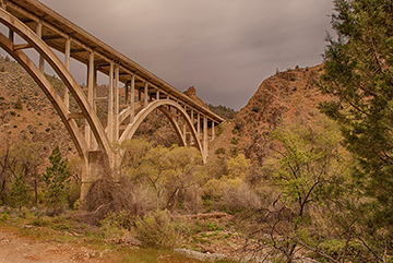
Always the scenic route. (click to enlarge) |
4-11-15 We stayed just outside of Redding California last night. That put us a quick drive from Jonni and Gary's and we arrived around noon. On the drive we passed Shasta lake and saw first hand how the California drought has taken its toll on it and on many other of California's watershed and recreation areas. If it were only the drought to blame, what could we do but cross our fingers and pray for rain. But the lack of rain fall is not the only reason our lakes, rivers and aqueducts are tragically low. All up the state as we drove the signs that the farmers are in need of water make it perfectly clear that they put the blame squarely on the government and their priorities over everything but its citizens. Sad and shameful situation out here in the once golden state.
Enough of that for now.
It was good to see Jonni and Gary. It had been too many years and they are familia. Gary has caught the gold bug and spends his days working a claim in the Klamath River area. I was able to get some drone time in above his claim and got some real good video we will share on the site when we get back.
Tomorrow we are blasting off early and racing up the starting point of our great adventure at the Canadian Border at Blaine. |
 |
-------
 |
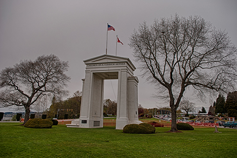
4-12-15 We made it in pretty good time. Blaine Washington is right on the Canadian border. We got a chance to walk around a little. Here is a picture of the Peace Arch. This monument is commemorating the long standing open door policy between the United States and our Canadian cousins to the north. The border runs right through the middle of it and it is very interesting to see. We will be starting our adventure from Peace Arch Park around sunrise tomorrow morning with a little video and a quick drone flight. I have to take a moment and commend the Border patrol here at our northern border. While scouting the park for our shoot in the morning I got a chance to talk to one of the agents and asked him if we could fly the drone and he took the time to get it cleared by his supervisor with the promise that I would not try and get any pictures of the border crossing facilities itself. I think clear guidelines and a no muss no fuss attitude is what more of our government agencies should be about.
God bless America! |
-------
4-13-15 After a successful kickoff at the border we hit the road heading south to the only place we needed to be at a particular time and place. The ferry to Port Townsend. We headed off of highway 5 south of Bellview Washington and headed west on state highway 20. This route is island hopping and we got a little alarmed when every sign along the route mentioned that reservations for the ferry are strongly recommended. This road also turned out to be much slower than I had anticipated. To make a long story short after stopping along the way for some pictures we just made the ferry and thank god we were able to get aboard without a reservation. I was planning to get some great shots from the bow of the ferry on the way over but the skies and seas had other ideas. By the time we hit Port Townsend it was raining pretty good, but that did not hinder us at all and we headed west. By the time we hit Port Angeles it was obvious that we were not going to get the pictures or drone flights I wanted to get along the strait of Juan De Fuca, so I called an audible from the line of scrimmage and decided we would not head out out 112 towards Cape Flattery and instead stay on the 101. I knew of a great spot called the Crescent Lake Resort and figured we could hole up there for the night. Kids make a note of this. The Crescent Lake Resort is seasonal and does not open until May 1st. So off we headed towards the next resort that was supposed to be at a hot springs. However as we started to head up the mountain towards it, it began to snow. No chains, 12 miles in on a maybe that it would be open did not appeal to Miss Lynn so back to the 101 and over to Forks Washington where we will hole up for the night. With the first day in the books I am going to call it half a success. While we are not spending the night close Cape Flattery we are within striking distance and as long as the weather cooperates in the morning we will still get our hike, drone flight and pictures we wanted at the furthest northwest point of the continental United States.
Side note: Forks Washington was once a thriving Lumber town but after the collapse of that industry the town might have gone under had not been for a little movie called Twilight that brought some fame and tourist dollars back to the community.
WOOO HOOO I thought they were Crappy movies but Miss Lynn liked them, and if they help this beautiful little town survive I say BUENA FORTUNA! |

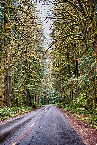
A long lonesome road near Crescent Lake, Washington (click to enlarge) |
-------
|

